
MINNESOTA, USA — We'll have a mix of sun and clouds across the region today ahead of our next storm system. There will be a few showers moving into central Minnesota this early afternoon, with a few sprinkles or spotty showers in the metro area. It doesn't look very wet.

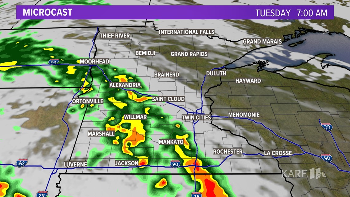
However, a strong low pressure system will approach the region tonight with widespread rain and embedded thunderstorms lifting through the region much of Tuesday. The beginning of the morning commute could start dry, but we'll be using our wipers driving on wet roads as the day rolls on.

Temperatures will be steady in the 50s under cloudy skies as showers and downpours roll across the region.

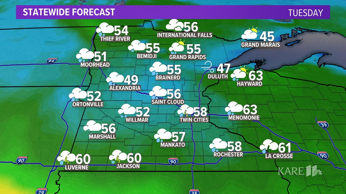
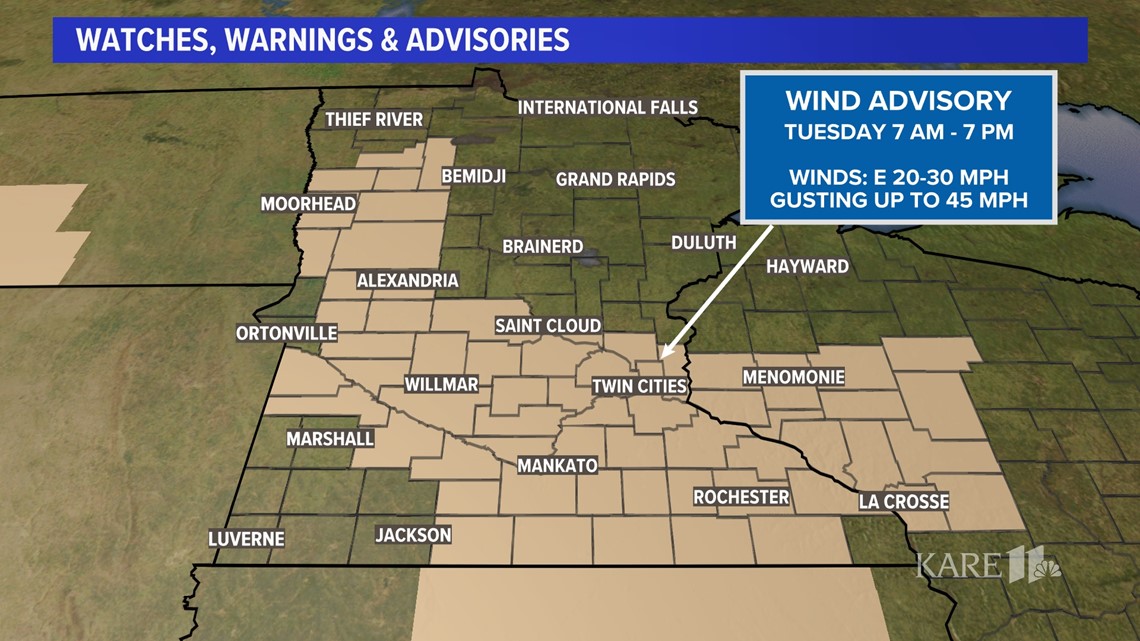
In addition to heavy rain, we'll be dealing with strong winds as this storm system arrives from the southwest. Wind gusts of 45 mph are possible throughout the morning and afternoon hours.

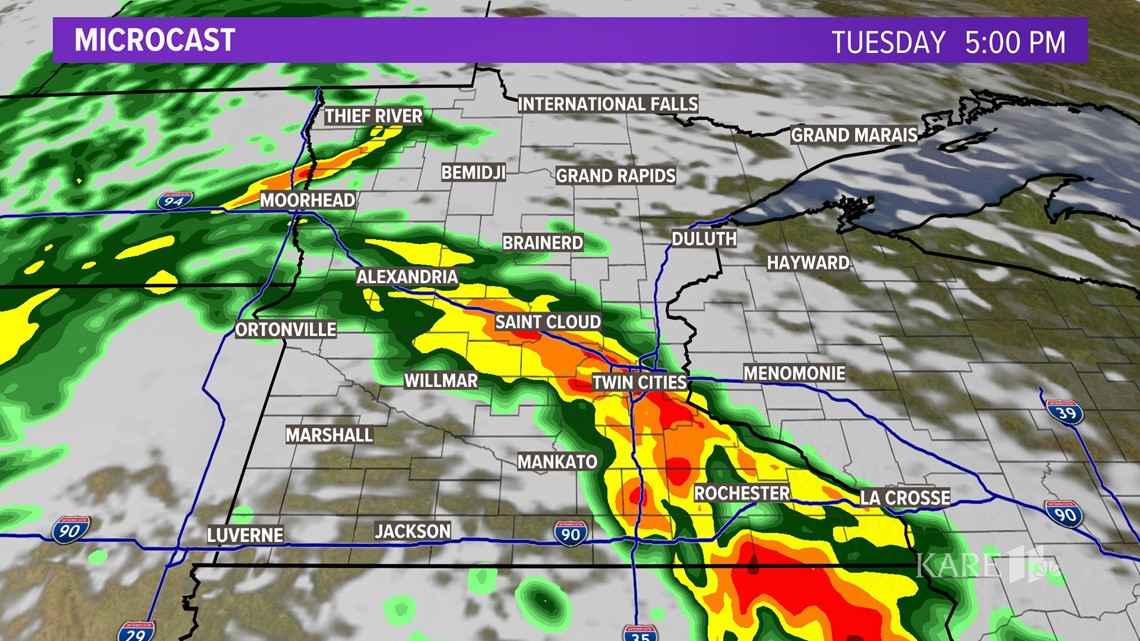
A band of heavy rain is expected to have a big impact on our evening commute around the metro area as well as traffic along I-94 towards St. Cloud and I-35 towards Albert Lea. That heavy rain will extend into southeastern Minnesota before lifting northeast into western Wisconsin.

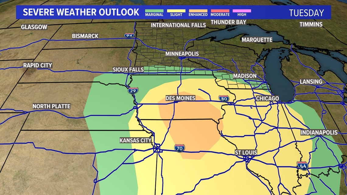
While we deal with showers, thunderstorms and downpours; there will be a greater threat of severe weather in Iowa and Missouri. There will be a low threat of severe storms for those communities along the I-90 Corridor in southern Minnesota.

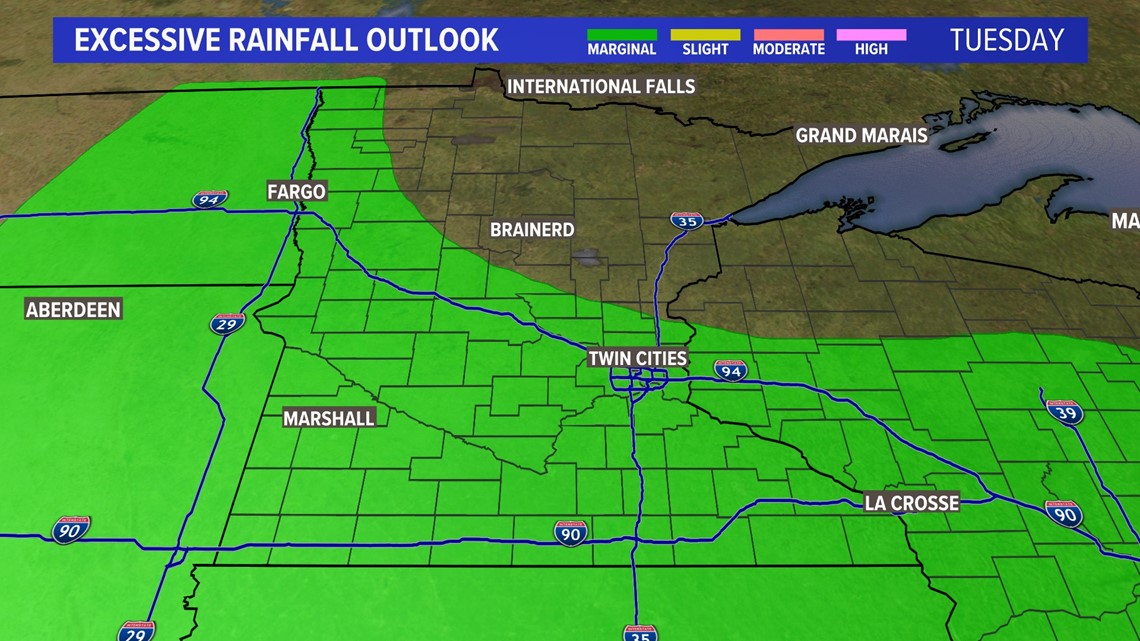
There is a low risk of excessive rainfall and flash flooding for a good portion of the region on Tuesday. The primary concern will be for flooded farmland, ponding on roadways and standing water. Drive with caution to avoid hydroplaning.

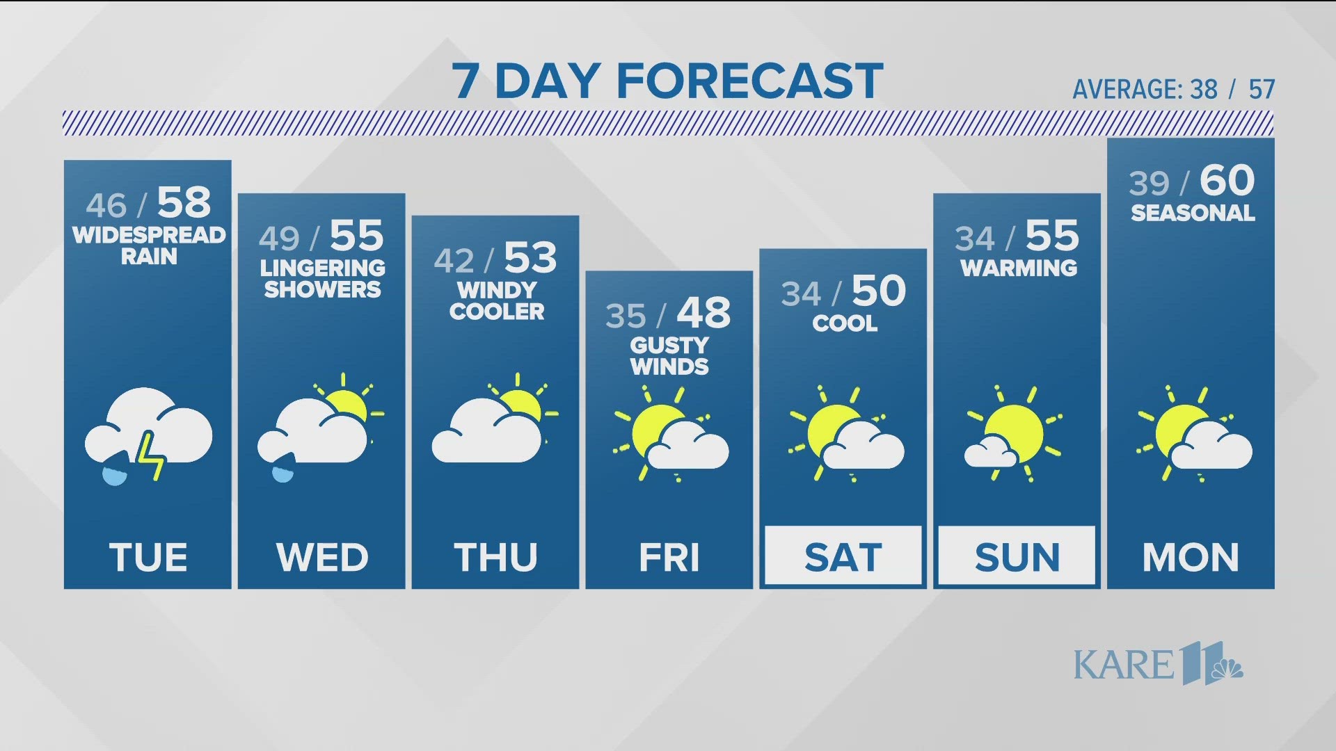
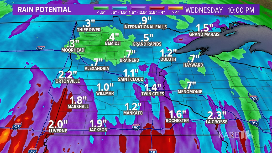
As this storm system exits the region on Wednesday, it will have left a significant amount of rain on the area. Rainfall totals of 1 inch are possible all the way to the southern shores of Lake Mille Lacs. After two rounds of heavy rain, rainfall totals of 1 to 1.5 inches are possible over the southern half of the state with the heaviest rain in southwestern and southeastern Minnesota where storms are expected to be strongest.

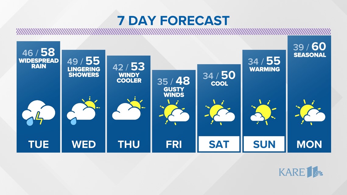
Temperatures will be trending downward behind our midweek rainmaker; we'll stay below average the remainder of the week. While this upcoming weekend looks cooler than the last, we should still see a good amount of sunshine.

Text your weather-related photos or videos to 763-797-7215. While you're at it, save KARE 11 as a contact on your phone!
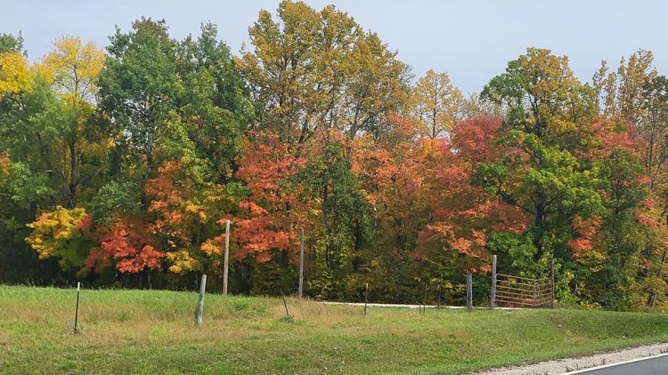
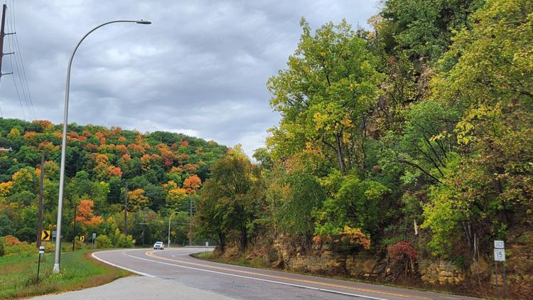
PHOTOS: Fall colors popping across Minnesota


WATCH MORE ON KARE 11+
Download the free KARE 11+ app for Roku, Fire TV, Apple TV and other smart TV platforms to watch more from KARE 11 anytime! The KARE 11+ app includes live streams of all of KARE 11's newscasts. You'll also find on-demand replays of newscasts; the latest from KARE 11 Investigates, Breaking the News and the Land of 10,000 Stories; exclusive programs like Verify and HeartThreads; and Minnesota sports talk from our partners at Locked On Minnesota.
- Add KARE 11+ on Roku here or by searching for KARE 11 in the Roku Channel Store.
- Add KARE 11+ on Fire TV here or by searching for KARE 11 in the Amazon App Store.
- Learn more about the KARE 11+ app for Apple TV in the Apple App Store.
- Learn more about KARE 11+ here.
Watch more WeatherMinds:
Watch the latest deep dives and explainers on weather and science in our YouTube playlist: