
ST PAUL, Minn. — The aftermath of last week's storms has caught up with Minnesota's streams and rivers, with several areas across the state approaching flood stage this week.
While KARE 11 meteorologist Laura Betker said there's no catastrophic flooding on the horizon, it's something to keep an eye on.
"There were parts of western and central Minnesota that got five-plus inches of rain last week. So, all of that water has to go somewhere," Betker said. "It makes its way eventually to the bigger rivers and continues to move downstream."
According to the National Weather Service river forecasts as of 9 p.m. Monday, the Mississippi River at St. Cloud, Hastings and Wabasha had reached minor flood stage, while the Mississippi at Fridley and St. Paul remained at "action" stage. In St. Paul, the city proactively decided to close part of Water Street and other nearby trails due to high water risk, although that's something that happens almost every year.
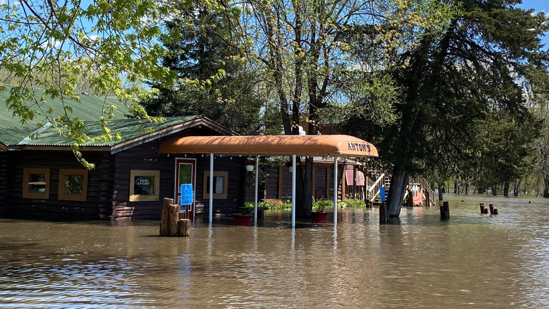
Some areas of the state are experiencing more significant flood levels, including the Sauk River just west of St. Cloud, where Anton's Restaurant announced it had temporarily closed after water rushed into the building.
Along the Minnesota River west of the metro, the area near Morton reached moderate flood stage, while Montevideo was projected to hit major flood stage.
"That's one of the spots to keep in mind when we're talking about major flooding," Betker said, pointing out that Montevideo is a flood-prone area. "A lot of the other spots are kind of in the minor category. There are some moderate flooding situations around Redwood Falls, certainly up in St. Cloud... and up along the Mississippi in Aitkin as well. That's another area with moderate flooding."
While riverways more north of the Twin Cities are already cresting, it could take a few more days for other areas to see receding water. The situation also depends on what happens with a potential round of thunderstorms moving through Thursday.
"I think we'll see a slow increase here through next weekend, before everything finally starts to recede again," Betker said.
In St. Paul, a Public Works spokesperson said the city will wait for the water to recede on the Mississippi before reassessing Water Street and other parks and trails in the area. After sweeping these areas clean of debris from the high waters, the city can then reopen them to the public.
Nick Allen, who lives near the riverfront in St. Paul, took a stroll along the Mississippi with his two dogs on Monday, acutely aware of the potential for minor flooding.
On Monday night, though, St. Paul remained about two feet below minor flood stage.
"It's always interesting to read the high level meters and marks," Allen said. "I don't think we're quite there yet."
Watch more local news:
Watch the latest local news from the Twin Cities in our YouTube playlist: